


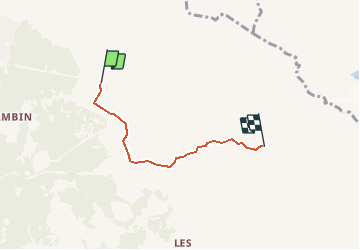


19,3 km | 32 km-effort


Benutzer


Kostenlosegpshiking-Anwendung
 SityTrail
IGN / Geografische Institute
SityTrail World
Die Welt öffnet sich für Sie
Tour Wandern von 3,4 km verfügbar auf Wallis, Entremont, Val de Bagnes. Diese Tour wird von yveshumbert vorgeschlagen.
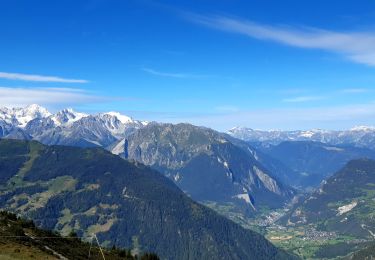
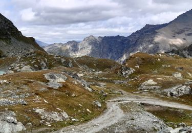
On commence la marche à l’arrivée des télécabines des Ruinettes.
Pour se rendre à la cabane Mt-Fort, on suit le bisse pendant un bon moment avant d’entreprendre une courte montée pour arriver à la cabane
Wandern
Zu Fuß
Zu Fuß
Wandern

Zu Fuß
Zu Fuß

Wandern

Wandern
Wandern